Soil Associations
0871a LAPLOYD
Soil and site characteristics
Permeable gritty coarse loamy upland soils with a wet humose or peaty surface horizon affected by groundwater. Some peat soils and some bare rock.
Geology
Granite and other acid igneous rock
Cropping and Land Use
Moorland and wetland habitats; stock rearing.
Component soil series
| Subgroup | Series name | Percentage | WRB 2006 link |
|---|---|---|---|
| 8.71 | LAPLOYD | 55% | Endoskeletic Dystric Histic Gleysols |
| 8.71 | FORDHAM | 20% | Umbric Gleysols |
| 10.13 | CROWDY | 10% | Ombric Sapric Histosols |
Covers 84 km2 in England and Wales
Soilscapes Classification
| 19 |
Slowly permeable wet very acid upland soils with a peaty surface |
0871a LAPLOYD
Detailed Description
This association consists predominantly of ground-water gley soils formed in drift derived mostly from acid igneous rocks with some slate. The soils occupy low-lying ground affected by groundwater mainly in South West England on the granite outcrops and very locally on Exmoor. In north Wales they are on rhyolite and microgranite. The main soils are coarse loamy humic gley soils of the Laployd series, characterized by a humose or peaty topsoil overlying mottled sandy silt loam or sandy loam which becomes very stony at shallow depth. The soils are permeable but are waterlogged most of the time unless artificially drained. Wetness is caused by a high groundwater-table or from flushes. Similar but deeper soils of the Fordham series and raw oligo-amorphous peat soils of the Crowdy series are the main associates with some thinner peat soils on rock classed as Hepste series. West of Snowdon these soils occupy boulder-strewn land receiving drainage water from higher ground. Here as well as the main soils are found stagnopodzols of the Hexworthy and Hafren series and stagnohumic gley soils of the Wilcocks series. In Beddgelert Forest, drainage ditches reveal the local variability of the substrata which contain fragments and boulders of a range of igneous and metamorphic rocks. Fordham and Crowdy series predominate in some localities, with Laployd soils in debris from rocks upsIope. East of Beddgelert the association is on the Llyn Dinas Breccia and Lower Rhyolitic Tuffs and where thin peaty topsoils overlie rock debris there are Bangor soils. Crowdy soils occupy flush sites with Laployd and Fordham series on steeper slopes. The steepest slopes have brown podzolic soils with stagnopodzols found on some convexities. Near Blaenau Ffestiniog on microgranite, Laployd soils predominate, though much of the fine earth is probably derived from nearby slaty metamorphic rocks. The narrow floodplain with its alluvial gley soils at Tan-y-Grisiau is also included. On Aran Benllyn in the upper catchments of several north-flowing streams Laployd soils are developed in debris from rhyolites of the Aran ridge. Hafren profiles are a component of this unit on convex slopes. The association is also mapped in the Rhinog Hills where Fordham soils are found in drift from Cambrian gritstone and sandstone.
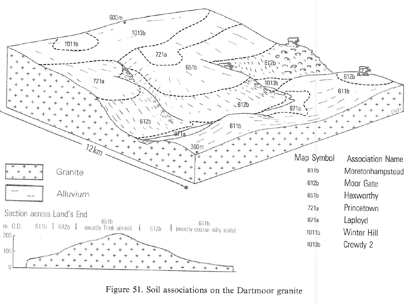
Some basins in granite country contain, fine loamy humic gleys of the Freni series and similar clayey profiles formed in drift from kaolinised granite. Included are narrow strips of wet alluvium, which in Cornwall has usually been disturbed in the search for alluvial tin or china clay. On Exmoor the flushed southern slopes of Dunkery Beacon have Fordham series with some patches of Hepste and Crowdy peat soils. In a few places on Dartmoor the soils have been mapped in basins on the high moorland, where deep peats of the Crowdy or Winter Hill series occur with Princetown soils.
Soil Water Regime
Undrained soils remain permanently wet (Wetness Class VI) from groundwater, the wetness aggravated by high rainfall in the uplands.
Cropping and Land Use
Undrained soils provide summer grazing of some value in dry seasons when the growth of grass on adjacent dry ground is checked by droughtiness. The soils provide wetland habitats for a wide variety of plants and animals. The semi-natural vegetation is often soft rush pasture or Molinia bog sometimes with tussocks of tufted hair-grass (Deschampsia cespitosa) or birch or willow scrub. Some drainage improvement is achieved by open ditches where this is not prevented by boulders and rock. Most of the land is used for rough grazing which is of moderate or low value with large tracts of bog-moss wetland in hollows. The peaty surface is difficult to improve by cultivations and the land is often subsequently invaded by rushes. Improved land is easily poached as the better herbage is preferred by stock, so careful control of grazing is essential. The irregular surface of much of the land prevents efficient drainage and ridging for forestry. Sitka spruce withstands the conditions best but growth is patchy in the wettest parts. Weeds do not normally interfere with tree growth but groundwater restricts the depth of rooting and windthrow is likely.
0871a LAPLOYD
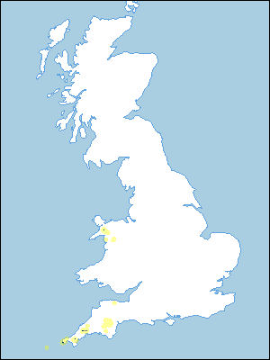
Distribution Map
 |
Note that the yellow shading represents a buffer to highlight the location of very small areas of the association.
Keys to component soil series
Wales
 |
Typical Landscapes
South Western Region
 |
All information Copyright, Cranfield University © 2025
Citation: To use information from this web resource in your work, please cite this as follows:
Cranfield University 2025. The Soils Guide. Available: www.landis.org.uk. Cranfield University, UK. Last accessed 04/04/2025
